
Appearance
Geometry
A geometry column can hold GeoJSON, WKT, or raw WKB/EWKB hex, and all three render. The third one is the interesting case: it means a plain SELECT geom from PostGIS works, with no conversion function wrapped around it.
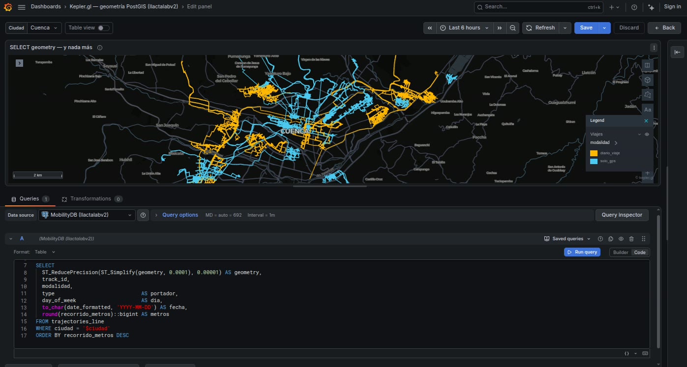
All of these work
sql
-- PostGIS: raw geometry, no conversion function at all
SELECT geom, name FROM neighbourhoods;

-- or projected to GeoJSON explicitly, if you prefer
SELECT ST_AsGeoJSON(geom) AS geojson, name FROM neighbourhoods;

-- WKT, from anywhere
SELECT ST_AsText(geom) AS wkt, name FROM neighbourhoods;

-- DuckDB over GeoParquet
SELECT CAST(ST_AsGeoJSON(geometry) AS VARCHAR) AS geojson, name
FROM read_parquet('s3://bucket/zones/*.parquet');
Why raw geometry works
kepler.gl's GeoJSON layer parses GeoJSON and WKT strings, but not WKB — a hex WKB column produces a blank map. Yet WKB hex is exactly what the two sources that matter here hand you: the Grafana PostgreSQL data source returns PostGIS geometry as EWKB hex, and DuckDB's ST_AsHEXWKB over GeoParquet returns ISO WKB hex.
So the plugin decodes it, in src/data/wkbToGeoJson.ts, before the value ever reaches kepler. The decoder walks the WKB structure properly — byte order, geometry type, the SRID/Z/M flags EWKB adds, and nested multi-geometries — and it verifies that it consumed exactly the whole buffer. A trailing-byte mismatch means the structure was misread, and it returns nothing rather than emitting a half-parsed geometry.
Anything that is not WKB hex — GeoJSON, WKT, free text — is passed through untouched for kepler to parse itself.
What this saves you
Without it, every query against a spatial database needs ST_AsGeoJSON(...) wrapped around the geometry, and every view and materialised table needs a GeoJSON twin. With it, the geometry column you already have is the one you select.
Detected column names
| Role | Names |
|---|---|
| Geometry | geom, geometry, the_geom, wkb_geometry, geojson, wkt, shape |
the_geom and wkb_geometry are there because they are what GeoServer and ogr2ogr produce by default. Anything else is mapped by hand under Field mapping → Geometry.
Internally the column is renamed to _geojson, which is kepler's own convention for a geometry column — which is why kepler builds the layer for it without being told to.
What can be in it
Whatever GeoJSON can express: points, lines, polygons, and their multi- forms, as well as collections. Polygons can be extruded into 3D from kepler's layer panel, and lines styled by any column in the row.
Mixing geometry types in one column works but is rarely what you want: a single layer gets a single set of styling controls, so points and polygons in the same column share a fill colour and fight over the radius. Two queries give you two layers and two sets of controls.
Coordinate reference systems
WGS84 only
The panel renders EPSG:4326 longitude/latitude degrees and does not reproject. A geometry in projected metres will be placed as though those metres were degrees — which puts a UTM easting of 720,000 somewhere well off the map.
EWKB carries an SRID, and the decoder reads the flag so it can skip the field correctly, but it does not transform coordinates. If your data is not in 4326, project it in the query:
sql
SELECT ST_Transform(geom, 4326) AS geom, name FROM parcels;For a WFS endpoint the equivalent is asking the server for 4326 explicitly with &srsName=EPSG:4326 — see Infinity. GeoServer otherwise returns the layer's native CRS, which is very often projected metres.
Volume
Geometry is heavier than points, by a lot: a detailed municipal boundary can be tens of thousands of coordinates, and a table of a few hundred of them is a large JSON payload before anything is drawn. Two things help, and both belong in the query rather than in the browser:
sql
-- simplify to a tolerance appropriate to the zoom you actually use
SELECT ST_Simplify(geom, 0.0005) AS geom, name FROM neighbourhoods;

-- and drop the coordinate precision you cannot see
SELECT ST_ReducePrecision(geom, 0.00001) AS geom, name FROM neighbourhoods;
Six decimal places is about 0.1 m at the equator. Anything beyond that is bytes you are paying to transport and cannot possibly see.