
Appearance
DuckDB — parquet, CSV and GeoJSON
The MotherDuck DuckDB data source reads spatial files directly — from disk, from S3, or over plain HTTPS — with no import step and no database to keep in sync. GeoParquet is the headline case, but the same data source also reads CSV, GeoJSON, shapefiles and about fifty other formats, which makes it the general answer to "I have a file and I want it on a map".
Before you start
Two things about the data source itself, both of which will waste an afternoon otherwise.
glibc, not Alpine
The DuckDB data source is linked against glibc and will not run on an Alpine-based Grafana image. Use a Debian or Ubuntu one — grafana/grafana:12.0.10-ubuntu.
It is also not in the Grafana catalog, so it installs from a release zip and is unsigned. It needs its own listing in allow_loading_unsigned_plugins — see Install for this panel's own catalog and signing status, which is independent of DuckDB's.
Leave the data source's path blank for an in-memory database. That is all you need for read_parquet(...); a .duckdb file is only for persisting your own tables.
Load the spatial extension once
From v0.4.5 the data source has an Init SQL field, and it runs per connection. Put the extension loading there rather than at the head of every query:
sql
INSTALL spatial; LOAD spatial;
INSTALL httpfs;  LOAD httpfs;   -- only if you read from S3 or HTTPS
Extensions do not persist across a backend restart, which is exactly why Init SQL exists.
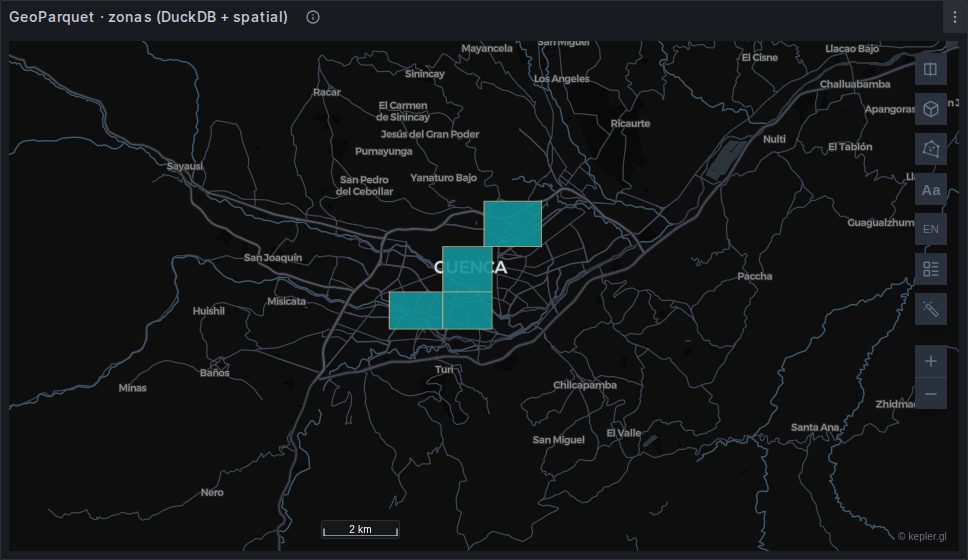
Geometry
sql
SELECT name,
       population,
       CAST(ST_AsGeoJSON(geometry) AS VARCHAR) AS geojson
FROM read_parquet('/data/zones.parquet');
Two details in that one line, and both are load-bearing.
Do not wrap it in ST_GeomFromWKB
With spatial loaded, a GeoParquet geometry column arrives as a native GEOMETRY carrying its CRS — not as a BLOB. ST_GeomFromWKB(geometry) is therefore a binder error, not a harmless no-op:
No function matches … st_geomfromwkb(GEOMETRY('EPSG:4326'))ST_AsGeoJSON(geometry) is the whole conversion.
Cast to VARCHAR. ST_AsGeoJSON returns DuckDB's JSON type, which the data source's Go driver cannot scan into a string — you get unsupported Scan … map[string]interface{}.
ST_AsText (WKT) and ST_AsHEXWKB (WKB hex) also render; the panel decodes the latter.
Points
If the parquet already has coordinate columns, no extension is needed at all:
sql
SELECT name, category, visitors,
       point_latitude  AS latitude,
       point_longitude AS longitude
FROM read_parquet('/data/points.parquet');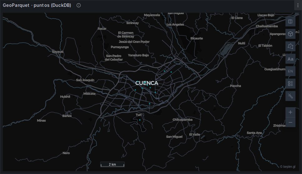
Otherwise take them from the geometry:
sql
SELECT name, ST_Y(geometry) AS latitude, ST_X(geometry) AS longitude
FROM read_parquet('/data/points.parquet');
CSV
read_csv_auto sniffs the types for you, which is the reason to prefer this over Infinity's CSV parser when you have DuckDB available:
sql
SELECT name, category, visitors,
       point_latitude  AS latitude,
       point_longitude AS longitude
FROM read_csv_auto('/data/points.csv');
Numeric columns come back as numbers. Infinity types every CSV column as string unless you set each one by hand — the mistake that puts every point at (0, 0) — and here that class of error simply does not arise.
It reads over HTTP as well, with httpfs loaded:
sql
SELECT * FROM read_csv_auto('https://example.org/data/points.csv');Override the sniffer when it guesses wrong:
sql
SELECT * FROM read_csv_auto('/data/points.csv',
                            types = {'zone_id': 'VARCHAR'});   -- keep the leading zeros
GeoJSON, shapefiles and the rest
The spatial extension bundles GDAL, so ST_Read opens whatever GDAL opens:
sql
SELECT name, population,
       CAST(ST_AsGeoJSON(geom) AS VARCHAR) AS geojson
FROM ST_Read('/data/zones.geojson');
ST_Read names the geometry column geom and adds an OGC_FID. It reads over HTTP too:
sql
SELECT name, CAST(ST_AsGeoJSON(geom) AS VARCHAR) AS geojson
FROM ST_Read('https://example.org/data/zones.geojson');
Never SELECT * from ST_Read
It looks like it works. The query succeeds, the rows arrive, and there is a column called geom — which is a name the panel detects as geometry. And nothing renders.
The raw GEOMETRY marshals to the frontend as raw WKB bytes, not hex and not text. The panel decodes WKB hex; it cannot do anything with mangled binary, and there is no error to tell you so.
Always convert explicitly — CAST(ST_AsGeoJSON(geom) AS VARCHAR), ST_AsText(geom) or ST_AsHEXWKB(geom).
What it can open
Fifty-three drivers in the build this plugin was tested against. Ask your own install:
sql
SELECT short_name FROM ST_Drivers() WHERE can_open ORDER BY short_name;The ones you are most likely to want: GeoJSON, ESRI Shapefile, GPKG, FlatGeobuf, KML, GPX, GML, TopoJSON, OpenFileGDB, MVT, PMTiles, OSM, GTFS, XLSX — and WFS, which means DuckDB can read a WFS service directly rather than going through Infinity.
A shapefile is the case worth calling out, since it arrives as four or five sibling files: point ST_Read at the .shp and it finds the rest.
sql
SELECT CAST(ST_AsGeoJSON(geom) AS VARCHAR) AS geojson, *
FROM ST_Read('/data/parcels.shp');
Reproject on the way in
Unlike the panel, DuckDB can reproject. If the file is not in WGS84:
sql
SELECT CAST(ST_AsGeoJSON(ST_Transform(geom, 'EPSG:32717', 'EPSG:4326')) AS VARCHAR) AS geojson
FROM ST_Read('/data/parcels.shp');
That is often the tidiest place to fix a projected shapefile — no GIS software, no conversion step, just the query.
Reading from S3 and HTTPS
sql
-- an object store
SELECT name, CAST(ST_AsGeoJSON(geometry) AS VARCHAR) AS geojson
FROM read_parquet('s3://bucket/zones/*.parquet');

-- a plain HTTPS URL
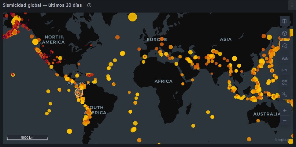
SELECT * FROM read_parquet('https://example.org/data/quakes.parquet');
Both need httpfs. Credentials for a private bucket go in the data source configuration, not in the query.
force_download, and when you want the opposite
sql
SET force_download = true;This is not a performance tweak
It changes how the file is read. By default DuckDB issues ranged requests and reads only the parquet pages it needs — which is the entire point of parquet on an object store, and you want it.
Set force_download when the endpoint builds the file per request: successive ranged reads then see different ETags and DuckDB aborts with "the remote file has changed". One whole-file GET sidesteps it. On a stable object store, leave it off.
The plugin's own earthquakes bench sets it, because its source generates the parquet on demand — at 378 KB, downloading the lot is free.
Variables: do not quote them
WARNING
The DuckDB data source interpolates variables with Grafana's SQL-string format, which adds the quotes itself. Write $var, not '$var' — the latter arrives as ''value'' and fails to parse.
Then guard the empty value with a cast that tolerates it:
sql
WHERE ts >= coalesce(try_cast($mapFrom AS TIMESTAMPTZ), '-infinity')
  AND ts <  coalesce(try_cast($mapTo   AS TIMESTAMPTZ), 'infinity')
This is the opposite of the PostgreSQL data source's behaviour. A query is not portable between the two without changing the quoting.
Provisioned dashboards
If you hand-write dashboard JSON rather than using the query editor, the DuckDB target needs "format": 1 — the query format is a numeric enum and QueryFormat.Table is 1. The string "table" produces an empty frame with no error.
When to reach for it
| DuckDB | Infinity | PostGIS | |
|---|---|---|---|
| Data lives in | files — local, S3, HTTPS | any URL | a database |
| Formats | parquet, CSV, GeoJSON, shapefile, ~50 more | JSON, CSV, XML, GraphQL | whatever you loaded |
| Column types | sniffed, correctly | strings unless you set each one | the database's |
| Reprojection | yes, ST_Transform | no | yes |
| Spatial predicates | yes | no | yes, with indexes |
| In the catalog | no, and unsigned | yes, signed | yes |
| Runs on Alpine | no, glibc only | yes | yes |
For a periodically-refreshed extract that many dashboards read, DuckDB over parquet is hard to beat. For anything transactional, use the database.