
Appearance
Infinity — GeoJSON, CSV and WFS
The Infinity data source fetches a URL and flattens the response into rows. It is in the Grafana catalog and signed, which makes it the lowest-friction way to get external data onto the map — no database, no server.
GeoJSON from a URL
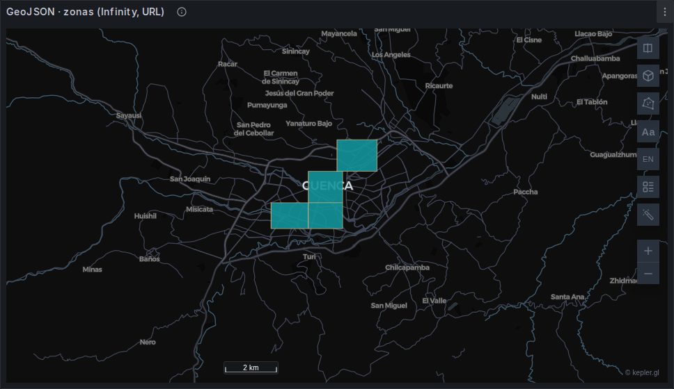
| Setting | Value |
|---|---|
| Type | JSON |
| Source | URL |
| Parser | Backend |
| URL | your .geojson |
| Rows / Root selector | features |
Then the columns:
| Selector | Alias | Type |
|---|---|---|
geometry | geojson | String |
properties.name | name | String |
properties.population | population | Number |
The one that matters is geometry → String. Infinity serialises the nested geometry object to a GeoJSON string when the column type is String — no JSONata needed — and the panel autodetects a column named geojson as the geometry.
CSV
| Setting | Value |
|---|---|
| Type | CSV |
| Source | URL |
| Parser | Backend |
Set the coordinate columns to Number
Infinity's CSV parser types everything as string by default. Latitude and longitude columns left as strings parse to zero, and every point lands at (0, 0) — the cluster in the Gulf of Guinea that this mistake is famous for.
Set lat/lng and any numeric measure to Number. Geometry columns stay String.
DuckDB is the better CSV reader, if you have it
read_csv_auto sniffs the types, so numeric columns arrive as numbers and this whole class of mistake disappears. See DuckDB.
Both column conventions work. The panel's own roles (latitude/lon/geom/…) are matched first, and kepler then applies its own on top — so a CSV with point_latitude / point_longitude renders even though neither name is in the panel's list, because kepler recognises the <prefix>_lat / <prefix>_lng pairing. A column of WKT or GeoJSON strings likewise becomes a polygon layer.
WFS
A WFS endpoint that speaks GeoJSON is just a URL, and works exactly like the GeoJSON case:
https://geoserver.example.org/wfs
  ?service=WFS&version=2.0.0&request=GetFeature
  &typeNames=ns:layer
  &outputFormat=application/json
  &srsName=EPSG:4326
Request WGS84 explicitly
&srsName=EPSG:4326 is not optional. GeoServer otherwise returns coordinates in the layer's native CRS, which is very often projected metres — and the panel renders WGS84 degrees and does not reproject, so a UTM easting of 720,000 is read as 720,000 degrees and the data lands nowhere.
DuckDB can also read a WFS directly — GDAL ships a WFS driver — which avoids hand-building the query string. See DuckDB.
Add &count=5000 while you are building the panel. A GetFeature with no limit against a large layer will happily try to send you the whole thing.
Reading into arrays
Infinity's backend parser can index into arrays with a dotted path, which is what makes APIs that return parallel arrays usable.
Open-Meteo is the case that matters here: asked for several coordinates it returns a JSON array of location objects, each carrying latitude, longitude and an hourly object of parallel arrays. Leave the root selector empty so each location becomes a row, and index the first timestep:
| Selector | Alias | Type |
|---|---|---|
latitude | latitude | Number |
longitude | longitude | Number |
hourly.wind_speed_10m.0 | speed | Number |
hourly.wind_direction_10m.0 | direction | Number |
That yields one row per grid point with a speed and a direction.
It is not enough on its own for a wind field
Open-Meteo snaps each requested coordinate to its own model grid, so a clean 7 × 7 request comes back as an irregular scatter — 11 distinct latitudes and 46 longitudes across 49 points, measured. The panel's velocity field detection needs a regular lattice, and an irregular one produces rows with an empty map and no error.
Fixing it means rounding the coordinates back, which Infinity cannot do. Use DuckDB's read_json_auto for that case — see Tutorial 6.
Authentication
Infinity handles Basic, Bearer, API key, OAuth2 and mTLS in the data source configuration. Put credentials there, never in the URL — a URL lives in the dashboard JSON and travels with every export and every shared link.
Provisioned dashboards
If you hand-write dashboard JSON, the Infinity target needs url_options with a method:
json
"url_options": { "method": "GET" }Without it Infinity's frontend throws Cannot read properties of undefined (reading 'method') and the panel shows an error — even though the backend query succeeds. The query editor fills this in for you; it only bites hand-written JSON.
Caching
Infinity's response is fetched on every query, so a panel with a 10-second refresh is a request every 10 seconds to whoever's server. For a feed that updates hourly, set the dashboard refresh to match, and be a good citizen about public endpoints.
When to reach for it
Good for: a public feed, a colleague's file on a web server, a WFS, an internal REST API, anything you would otherwise have to import first.
Reach for something else when: the data is large (it is fetched and parsed on every query), you need spatial predicates (PostGIS), or the file is a CSV, a shapefile, a GeoPackage or anything columnar — all of which DuckDB reads with its types intact.